
26 September - 27 October 2019
FINEST is the acronym used to indicate two countries, Finland (FIN) and Estonia (EST) and their drive towards urban integration.
For the Torino Graphic Days festival of 2019, Wild Mazzini exhibits two maps, respectively of Helsinki and Tallinn. Data processing has produced detailed maps that reveal just how much the two capitals have in common, despite being separated by a 90 km stretch of Baltic Sea. With a view to the project of an underwater rail link – part of the Baltic Rail of the TEN-T network – the two cities are in fact investigating the nature of their social, economic and cultural existence, in order to establish a synergic relationship.
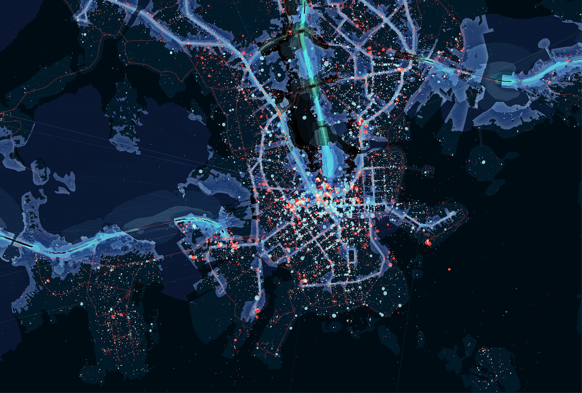
The installation consists of two photographic totems and two maps and is the result of data collection and visualization work carried out by SPIN Unit. This company is headed by Damiano Cerrone and composed of a multidisciplinary team of experts from all over Europe that develops complex projects in the ancient and illustrious tradition of cartography.

The maps provide the viewer with a multifaceted perspective on the seemingly inflexible issues of urban planning and social systems, and they do so by combining the digital footprint of the city with physical and traditional elements, such as public transport routes. The data shows how people in these metropolitan areas live by representing them directly and without adulteration.

Damiano Cerrone
He is director of SPIN Unit, a transnational urban planning agency that combines scientific and artistic research to find innovative approaches to urban studies and advanced data analysis. He is also a Principal Researcher at Michael Sorkin’s TERREFORM CAUR in New York, researcher at the Spatial Ethnography Lab and conducts research and teaching activities at Tampere University and Beijing University of Technology.

He has been involved in research and consulting projects in Europe, the United States and Russia, with planning, public administration and international agencies such as the UNDP to conduct urban analyses and provide guidelines for interaction-based planning. He has received the ESRI Young Scholar Award In 2015 and the World Gold Award in 2016 for his work on digital geography from the Geoknowledge Foundation.


